UGANDA - Climate change mapping
Type of project: mapping + training
Status: ongoing / active
Trainer: Lisa Kathrin Polak
Background
Countries in the global south and their population are most affected by climate change: The seasons are less predictable and extreme weather conditions prevail. Floods, droughts, landslides, new crop diseases, termite invasion are just a few climate change impacts, distressing the lives of the most vulnerable in Uganda. It has not only direct effects on food security, but also on the economic and social welfare of Ugandans.
The Space2Live climate change mapping project is part of a capacity-building programme. The KAKAWE-CCAM programme aims at fostering resilience, reducing climate change risks and vulnerability, sensitising towards climate change inducing communal activities and enhancing adaptive capacity of five Ugandan organisations. It is a 3 year project to be implemented between May 2016 and December 2019. Its main goal is to build community resilience to climate change effects and variations in Central, Western and Eastern Uganda.
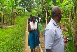
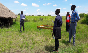
Space2Live´s assignment is to support local team staff in visualising and identifying important local resources, climate change inducing practices and effects with GPS data collection and mapping. The training subsequently leads to an enhanced spatial perception and sensitisation of an intertwined, integrated and sustainable community development. Maps produced will serve as an overview for local teams, when implementing climate change activities, and as argumentation basis towards local and regional authorities.
Approach
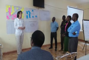
Space2Live conducted trainings (GPS technologies, mapping software and climate change aspects) with 5 organisations from April 2018 – June 2018 and concluded with an evaluation and milestone planning workshop for 2018. Space2Live is backstopping the Ugandan team until December 2019.
In September 2018 an ASA programme scholarship holder and geographer has additionally supported Space2Live efforts on site, working with two NGOs based in Kampala.
The 5 organisations – engaged in agricultural promotion and empowerment of women – are operative in 11 districts in Uganda. They started mapping in their respective operative areas and will be supervised by Space2Live team staff. A next evaluation step will be made in January 2019.
Outcomes
Ugandan NGO team staff has developed skills to capture spatial data on climate change issues and to visualise and explain the collected data in comprehensive maps. They also have a better understanding of climate change adaption and mitigation and a sustainable community development. Challenges concerning internet connection, mobile phone availability for GPS data collection and computer literacy arose during the training, consuming considerable time. Nevertheless, the team is highly motivated to continue working on the maps.