Innovative Tools to Protect Land Rights
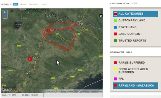
Space2Live actively promotes the use and spread of geographical analysis in the fight against land grabbing and eviction. Geospatial data becomes increasingly available through open source software and online platforms, and offers new possibilities to document cases of land rights violations around the world. The methods applied and promoted by Space2Live are easy enough to be used by non-professionals and require only limited resources, which increases its outreach and capacity. Space2Live raises awareness for these new possibilities among organizations, development professionals and policy-makers and provides technical advice on the use and application of such methods (see Training and Technical Assistance).
In the longer term, Space2Live aims to establish a framework with allows to share its data with a broader audience by using open source and crowd-mapping platforms. Crowd-mapping has gained increasing influence in recent years and serves as an important source of real-time information for civil activists and the media. Space2Live is currently establishing partnerships with open-source platforms and will soon start to channel its information through online media.